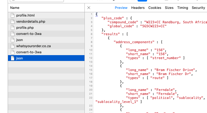
I am doing a reverse geocode lookup on with google and get a heck of a lot of info back. I only want to use formatted address on the page but just cannot get this right. Any help will be appreciated to know what to put in the little curly braces. Thanks
{
"plus_code" : {
"compound_code" : "5485+M3 Centurion, South Africa",
"global_code" : "5G6C5485+M3"
},
"results" : [
{
"address_components" : [
{
"long_name" : "Centurion",
"short_name" : "Centurion",
"types" : [ "locality", "political" ]
},
{
"long_name" : "Sunderland Ridge",
"short_name" : "Sunderland Ridge",
"types" : [ "political", "sublocality", "sublocality_level_1" ]
},
{
"long_name" : "City of Tshwane Metropolitan Municipality",
"short_name" : "City of Tshwane Metropolitan Municipality",
"types" : [ "administrative_area_level_2", "political" ]
},
{
"long_name" : "Gauteng",
"short_name" : "GP",
"types" : [ "administrative_area_level_1", "political" ]
},
{
"long_name" : "South Africa",
"short_name" : "ZA",
"types" : [ "country", "political" ]
},
{
"long_name" : "0157",
"short_name" : "0157",
"types" : [ "postal_code" ]
}
],
"formatted_address" : "147 Voortrekker Rd, Raslouw A H, Sunderland Ridge, Centurion, 0157, South Africa",
"geometry" : {
"location" : {
"lat" : -25.8334325,
"lng" : 28.1064319
},
"location_type" : "GEOMETRIC_CENTER",
"viewport" : {
"northeast" : {
"lat" : -25.83208351970849,
"lng" : 28.1077808802915
},
"southwest" : {
"lat" : -25.8347814802915,
"lng" : 28.1050829197085
}
}
},
"place_id" : "ChIJVVVVVbJklR4R258uPKGgpL8",
"plus_code" : {
"compound_code" : "5484+JH Centurion, South Africa",
"global_code" : "5G6C5484+JH"
},
"types" : [ "establishment", "point_of_interest" ]
},
{
"address_components" : [
{
"long_name" : "16",
"short_name" : "16",
"types" : [ "street_number" ]
},
{
"long_name" : "Sesmylspruit Street",
"short_name" : "Sesmylspruit St",
"types" : [ "route" ]
},
{
"long_name" : "Sunderland Ridge",
"short_name" : "Sunderland Ridge",
"types" : [ "political", "sublocality", "sublocality_level_1" ]
},
{
"long_name" : "Centurion",
"short_name" : "Centurion",
"types" : [ "locality", "political" ]
},
{
"long_name" : "City of Tshwane Metropolitan Municipality",
"short_name" : "City of Tshwane Metropolitan Municipality",
"types" : [ "administrative_area_level_2", "political" ]
},
{
"long_name" : "Gauteng",
"short_name" : "GP",
"types" : [ "administrative_area_level_1", "political" ]
},
{
"long_name" : "South Africa",
"short_name" : "ZA",
"types" : [ "country", "political" ]
},
{
"long_name" : "0157",
"short_name" : "0157",
"types" : [ "postal_code" ]
}
],
"formatted_address" : "16 Sesmylspruit St, Sunderland Ridge, Centurion, 0157, South Africa",
"geometry" : {
"location" : {
"lat" : -25.834191,
"lng" : 28.106687
},
"location_type" : "ROOFTOP",
"viewport" : {
"northeast" : {
"lat" : -25.8328420197085,
"lng" : 28.1080359802915
},
"southwest" : {
"lat" : -25.8355399802915,
"lng" : 28.1053380197085
}
}
},
"place_id" : "ChIJexfe46t8lR4R1Z2sWmQLrEY",
"plus_code" : {
"compound_code" : "5484+8M Centurion, South Africa",
"global_code" : "5G6C5484+8M"
},
"types" : [ "street_address" ]
},
{
"address_components" : [
{
"long_name" : "13",
"short_name" : "13",
"types" : [ "street_number" ]
},
{
"long_name" : "Sesmylspruit Street",
"short_name" : "Sesmylspruit St",
"types" : [ "route" ]
},
{
"long_name" : "Sunderland Ridge",
"short_name" : "Sunderland Ridge",
"types" : [ "political", "sublocality", "sublocality_level_1" ]
},
{
"long_name" : "Centurion",
"short_name" : "Centurion",
"types" : [ "locality", "political" ]
},
{
"long_name" : "City of Tshwane Metropolitan Municipality",
"short_name" : "City of Tshwane Metropolitan Municipality",
"types" : [ "administrative_area_level_2", "political" ]
},
{
"long_name" : "Gauteng",
"short_name" : "GP",
"types" : [ "administrative_area_level_1", "political" ]
},
{
"long_name" : "South Africa",
"short_name" : "ZA",
"types" : [ "country", "political" ]
},
{
"long_name" : "0157",
"short_name" : "0157",
"types" : [ "postal_code" ]
}
],
"formatted_address" : "13 Sesmylspruit St, Sunderland Ridge, Centurion, 0157, South Africa",
"geometry" : {
"location" : {
"lat" : -25.8341675,
"lng" : 28.1061974
},
"location_type" : "RANGE_INTERPOLATED",
"viewport" : {
"northeast" : {
"lat" : -25.8328185197085,
"lng" : 28.1075463802915
},
"southwest" : {
"lat" : -25.8355164802915,
"lng" : 28.1048484197085
}
}
},
"place_id" : "EkMxMyBTZXNteWxzcHJ1aXQgU3QsIFN1bmRlcmxhbmQgUmlkZ2UsIENlbnR1cmlvbiwgMDE1NywgU291dGggQWZyaWNhIhoSGAoUChIJr8GuZql8lR4RnFvld2ha0l4QDQ",
"types" : [ "street_address" ]
},
{
"address_components" : [
{
"long_name" : "7-13",
"short_name" : "7-13",
"types" : [ "street_number" ]
},
{
"long_name" : "Sesmylspruit Street",
"short_name" : "Sesmylspruit St",
"types" : [ "route" ]
},
{
"long_name" : "Sunderland Ridge",
"short_name" : "Sunderland Ridge",
"types" : [ "political", "sublocality", "sublocality_level_1" ]
},
{
"long_name" : "Centurion",
"short_name" : "Centurion",
"types" : [ "locality", "political" ]
},
{
"long_name" : "City of Tshwane Metropolitan Municipality",
"short_name" : "City of Tshwane Metropolitan Municipality",
"types" : [ "administrative_area_level_2", "political" ]
},
{
"long_name" : "Gauteng",
"short_name" : "GP",
"types" : [ "administrative_area_level_1", "political" ]
},
{
"long_name" : "South Africa",
"short_name" : "ZA",
"types" : [ "country", "political" ]
},
{
"long_name" : "0157",
"short_name" : "0157",
"types" : [ "postal_code" ]
}
],
"formatted_address" : "7-13 Sesmylspruit St, Sunderland Ridge, Centurion, 0157, South Africa",
"geometry" : {
"bounds" : {
"northeast" : {
"lat" : -25.8340829,
"lng" : 28.106837
},
"southwest" : {
"lat" : -25.8360509,
"lng" : 28.1060829
}
},
"location" : {
"lat" : -25.8350449,
"lng" : 28.1067242
},
"location_type" : "GEOMETRIC_CENTER",
"viewport" : {
"northeast" : {
"lat" : -25.8337179197085,
"lng" : 28.1078089302915
},
"southwest" : {
"lat" : -25.8364158802915,
"lng" : 28.1051109697085
}
}
},
"place_id" : "ChIJr8GuZql8lR4RnFvld2ha0l4",
"types" : [ "route" ]
},
{
"address_components" : [
{
"long_name" : "Zwartkop 356-Jr",
"short_name" : "Zwartkop 356-Jr",
"types" : [ "political", "sublocality", "sublocality_level_1" ]
},
{
"long_name" : "Centurion",
"short_name" : "Centurion",
"types" : [ "locality", "political" ]
},
{
"long_name" : "City of Tshwane Metropolitan Municipality",
"short_name" : "City of Tshwane Metropolitan Municipality",
"types" : [ "administrative_area_level_2", "political" ]
},
{
"long_name" : "Gauteng",
"short_name" : "GP",
"types" : [ "administrative_area_level_1", "political" ]
},
{
"long_name" : "South Africa",
"short_name" : "ZA",
"types" : [ "country", "political" ]
},
{
"long_name" : "0137",
"short_name" : "0137",
"types" : [ "postal_code" ]
}
],
"formatted_address" : "Zwartkop 356-Jr, Centurion, 0137, South Africa",
"geometry" : {
"bounds" : {
"northeast" : {
"lat" : -25.7948098,
"lng" : 28.1982289
},
"southwest" : {
"lat" : -25.848677,
"lng" : 28.0953579
}
},
"location" : {
"lat" : -25.8175031,
"lng" : 28.1298234
},
"location_type" : "APPROXIMATE",
"viewport" : {
"northeast" : {
"lat" : -25.7948098,
"lng" : 28.1982289
},
"southwest" : {
"lat" : -25.848677,
"lng" : 28.0953579
}
}
},
"place_id" : "ChIJUyrS0GRjlR4RBw61h9PMjSM",
"types" : [ "political", "sublocality", "sublocality_level_1" ]
},
{
"address_components" : [
{
"long_name" : "0137",
"short_name" : "0137",
"types" : [ "postal_code" ]
},
{
"long_name" : "Centurion",
"short_name" : "Centurion",
"types" : [ "locality", "political" ]
},
{
"long_name" : "City of Tshwane Metropolitan Municipality",
"short_name" : "City of Tshwane Metropolitan Municipality",
"types" : [ "administrative_area_level_2", "political" ]
},
{
"long_name" : "Gauteng",
"short_name" : "GP",
"types" : [ "administrative_area_level_1", "political" ]
},
{
"long_name" : "South Africa",
"short_name" : "ZA",
"types" : [ "country", "political" ]
}
],
"formatted_address" : "Centurion, 0137, South Africa",
"geometry" : {
"bounds" : {
"northeast" : {
"lat" : -25.79481,
"lng" : 28.1982291
},
"southwest" : {
"lat" : -25.848677,
"lng" : 28.0953579
}
},
"location" : {
"lat" : -25.8125956,
"lng" : 28.153228
},
"location_type" : "APPROXIMATE",
"viewport" : {
"northeast" : {
"lat" : -25.79481,
"lng" : 28.1982291
},
"southwest" : {
"lat" : -25.848677,
"lng" : 28.0953579
}
}
},
"place_id" : "ChIJ0_zSKGVjlR4RCbDg415yFeY",
"types" : [ "postal_code" ]
},
{
"address_components" : [
{
"long_name" : "Centurion",
"short_name" : "Centurion",
"types" : [ "locality", "political" ]
},
{
"long_name" : "City of Tshwane Metropolitan Municipality",
"short_name" : "City of Tshwane Metropolitan Municipality",
"types" : [ "administrative_area_level_2", "political" ]
},
{
"long_name" : "Gauteng",
"short_name" : "GP",
"types" : [ "administrative_area_level_1", "political" ]
},
{
"long_name" : "South Africa",
"short_name" : "ZA",
"types" : [ "country", "political" ]
}
],
"formatted_address" : "Centurion, South Africa",
"geometry" : {
"bounds" : {
"northeast" : {
"lat" : -25.7752948,
"lng" : 28.26202
},
"southwest" : {
"lat" : -25.9449101,
"lng" : 27.8903501
}
},
"location" : {
"lat" : -25.864029,
"lng" : 28.0888578
},
"location_type" : "APPROXIMATE",
"viewport" : {
"northeast" : {
"lat" : -25.7752948,
"lng" : 28.26202
},
"southwest" : {
"lat" : -25.9449101,
"lng" : 27.8903501
}
}
},
"place_id" : "ChIJJ0uV9Q17lR4RfyJicLptT0c",
"types" : [ "locality", "political" ]
},
{
"address_components" : [
{
"long_name" : "City of Tshwane Metropolitan Municipality",
"short_name" : "City of Tshwane Metropolitan Municipality",
"types" : [ "administrative_area_level_2", "political" ]
},
{
"long_name" : "Gauteng",
"short_name" : "GP",
"types" : [ "administrative_area_level_1", "political" ]
},
{
"long_name" : "South Africa",
"short_name" : "ZA",
"types" : [ "country", "political" ]
}
],
"formatted_address" : "City of Tshwane Metropolitan Municipality, South Africa",
"geometry" : {
"bounds" : {
"northeast" : {
"lat" : -25.1096099,
"lng" : 29.09842
},
"southwest" : {
"lat" : -26.0780899,
"lng" : 27.8903501
}
},
"location" : {
"lat" : -25.6051205,
"lng" : 28.3929417
},
"location_type" : "APPROXIMATE",
"viewport" : {
"northeast" : {
"lat" : -25.1096099,
"lng" : 29.09842
},
"southwest" : {
"lat" : -26.0780899,
"lng" : 27.8903501
}
}
},
"place_id" : "ChIJjVNCr-ravx4RPOYRWM0o7EU",
"types" : [ "administrative_area_level_2", "political" ]
},
{
"address_components" : [
{
"long_name" : "Gauteng",
"short_name" : "GP",
"types" : [ "administrative_area_level_1", "political" ]
},
{
"long_name" : "South Africa",
"short_name" : "ZA",
"types" : [ "country", "political" ]
}
],
"formatted_address" : "Gauteng, South Africa",
"geometry" : {
"bounds" : {
"northeast" : {
"lat" : -25.1096099,
"lng" : 29.0984187
},
"southwest" : {
"lat" : -26.92383,
"lng" : 27.1563401
}
},
"location" : {
"lat" : -26.2707593,
"lng" : 28.1122679
},
"location_type" : "APPROXIMATE",
"viewport" : {
"northeast" : {
"lat" : -25.1096099,
"lng" : 29.0984187
},
"southwest" : {
"lat" : -26.92383,
"lng" : 27.1563401
}
}
},
"place_id" : "ChIJn3cRVJUSlR4R4jhUy8fnnm0",
"types" : [ "administrative_area_level_1", "political" ]
},
{
"address_components" : [
{
"long_name" : "South Africa",
"short_name" : "ZA",
"types" : [ "country", "political" ]
}
],
"formatted_address" : "South Africa",
"geometry" : {
"bounds" : {
"northeast" : {
"lat" : -22.1254239,
"lng" : 38.2216904
},
"southwest" : {
"lat" : -47.1313489,
"lng" : 16.2816999
}
},
"location" : {
"lat" : -30.559482,
"lng" : 22.937506
},
"location_type" : "APPROXIMATE",
"viewport" : {
"northeast" : {
"lat" : -22.1254239,
"lng" : 38.2216904
},
"southwest" : {
"lat" : -47.1313489,
"lng" : 16.2816999
}
}
},
"place_id" : "ChIJURLu2YmmNBwRoOikHwxjXeg",
"types" : [ "country", "political" ]
}
],
"status" : "OK"
}